")
")
Seismic characterisation
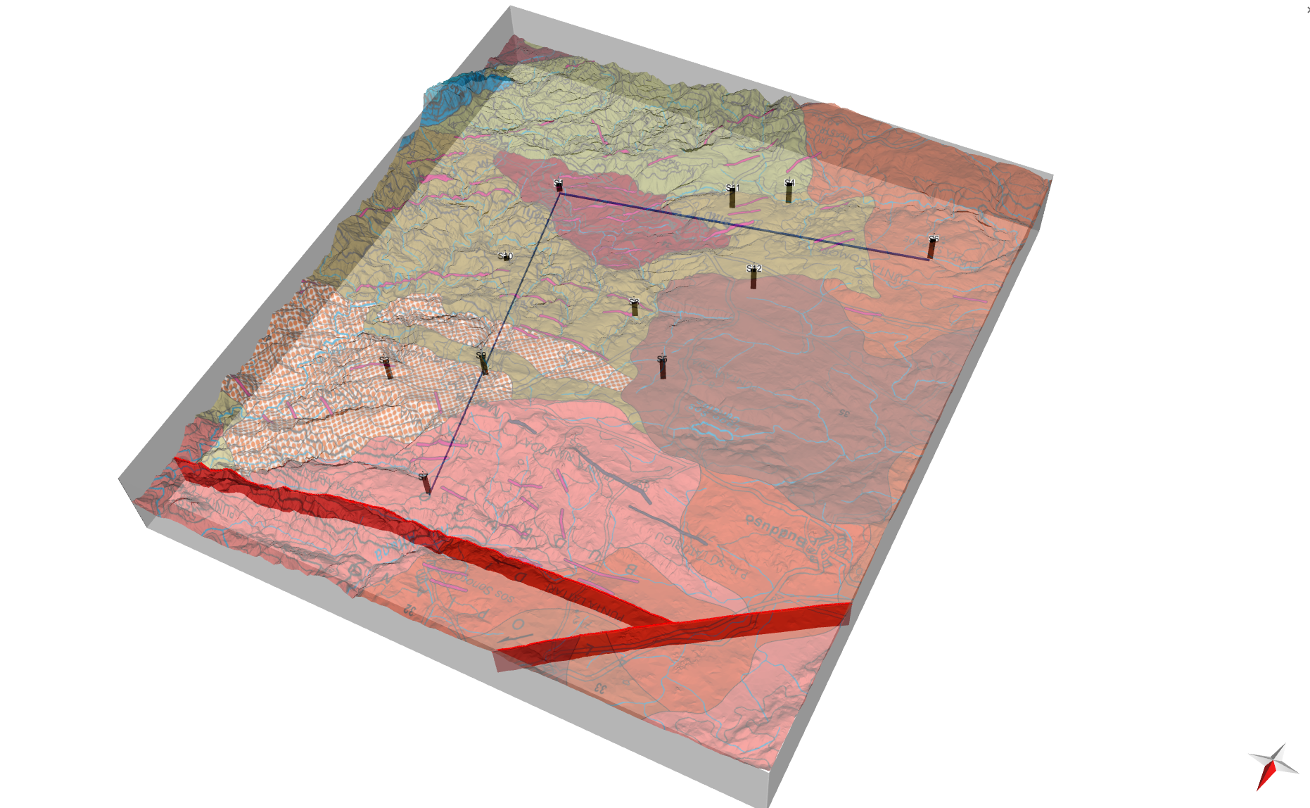
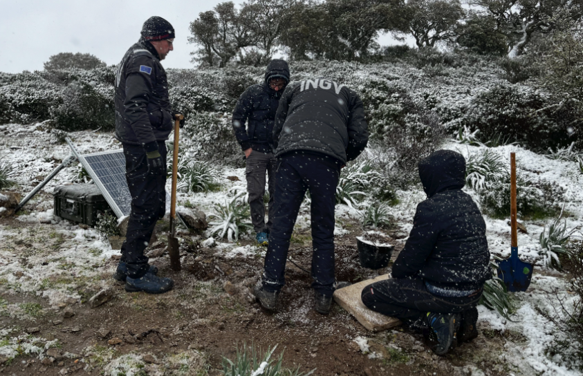
- EinsteinArray and GIANT network — A network of 12 broadband stations installed in boreholes around the candidate area, integrated with meteorological and infrasonic sensors and with the strengthening of the regional Sardinian network.
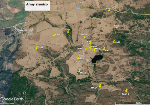
- Spiral seismic array (Mamone) — A measurement campaign specifically designed to characterise seismic noise in the 1–10 Hz band, the most critical for ET.
- Seismic velocity variations — Analysis of ambient seismic noise cross-correlations to monitor the elastic properties of the shallow crust over time.
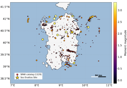
- Seismicity catalogue and source discrimination — Construction of a complete catalogue of Sardinian seismicity using machine learning techniques, with identification of anthropogenic events and estimation of moment magnitude through spectral inversions.
Approfondisci
EinsteinArray and strengthening of the Sardinian network (GIANT)
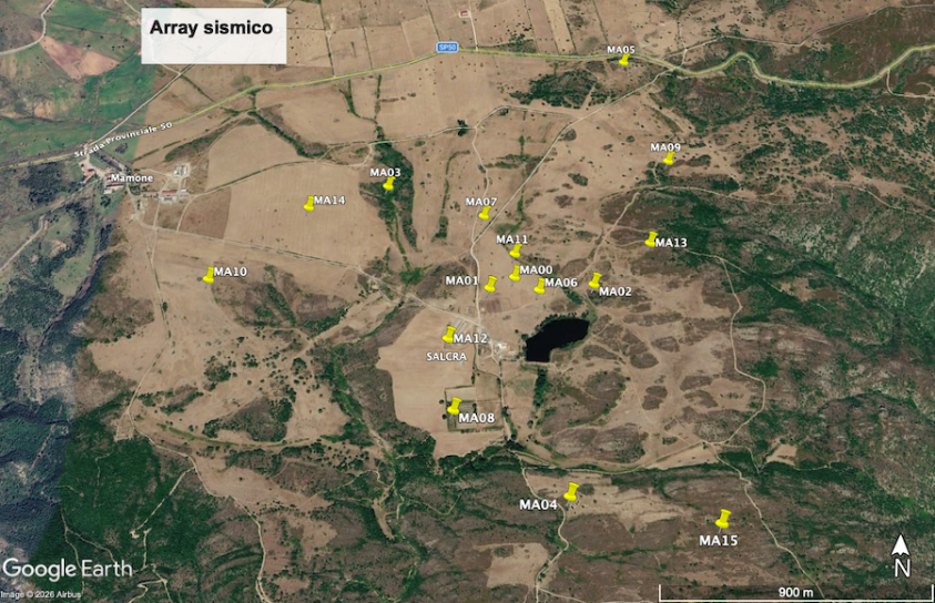
Spiral seismic array for the 1–10 Hz band
Monitoring of seismic velocity variations
Seismicity catalogue and source discrimination
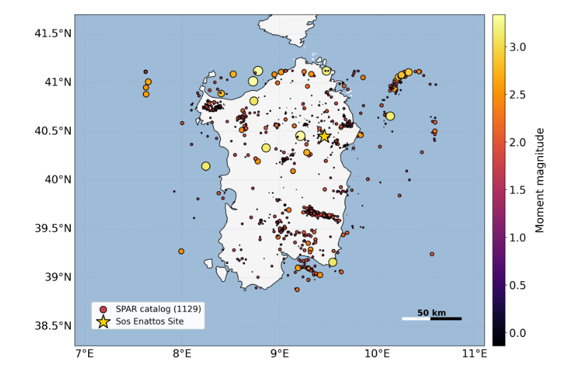
Map of the events (earthquakes and quarry explosions) that have been located and for which the Moment Magnitude Mw has been calculated, represented by the color of the circles
Electromagnetic characterisation
- CARMA-ET — Magnetotelluric campaign for the spatial and spectral characterisation of ambient magnetic noise and estimation of induced telluric currents.
- Audiomagnetotelluric surveys (AMT) — Reconstruction of the electrical resistivity structure of the subsurface down to 2 km depth.
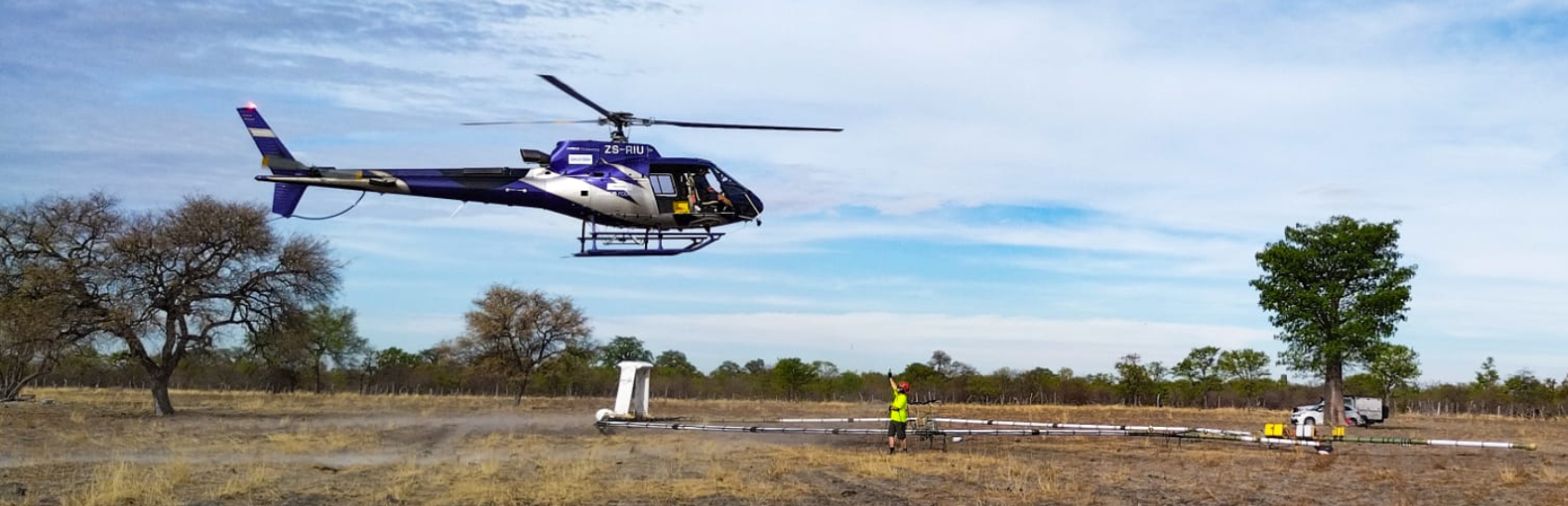
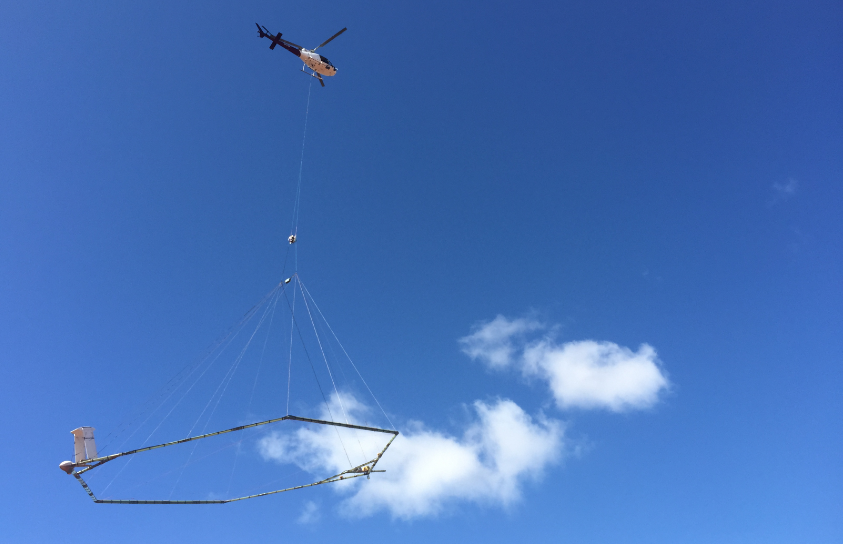
- Airborne electromagnetic prospecting (EinstAEM) — 3D modelling of subsurface resistivity and fracturing down to 500 m depth over approximately 400 km².
- Continuous magnetic monitoring — Permanent magnetic station for continuous monitoring of the geomagnetic field.
Approfondisci
CARMA-ET: characterisation of ambient magnetic noise
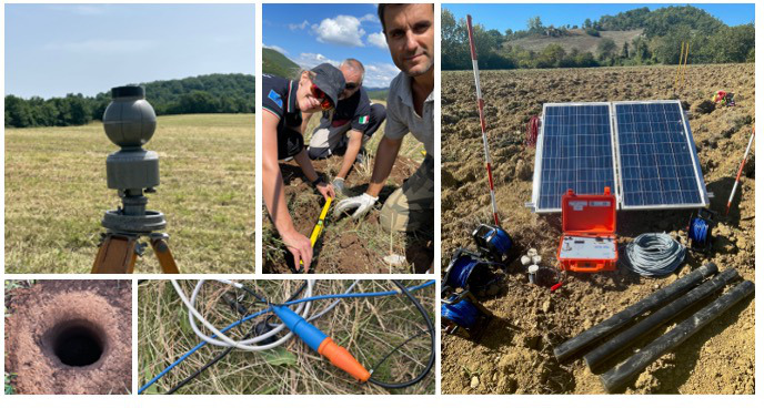
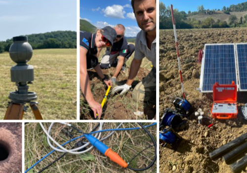
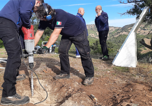
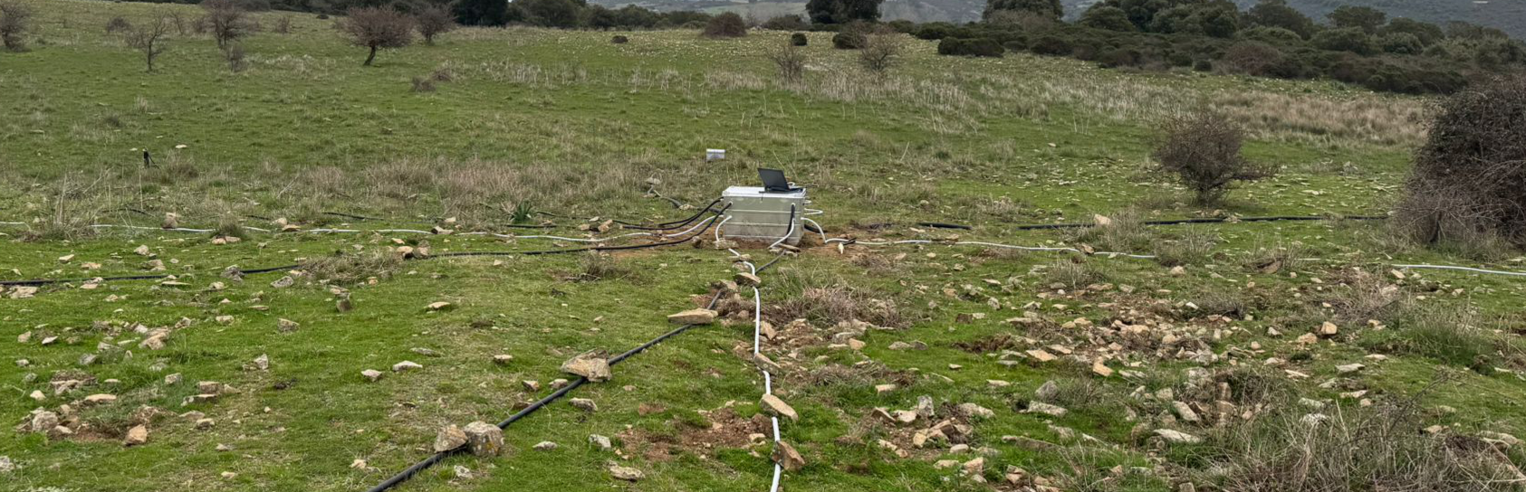
Field activities for ground electromagnetic measurements: sensor installation, electrode deployment, and setup of solar-powered acquisition equipment.
Audiomagnetotelluric surveys (AMT)
Airborne electromagnetic prospecting (EinstAEM)
 The airborne electromagnetic (AEM) system antenna suspended beneath a helicopter during a geophysical survey. The rigid loop carries the transmitter and receiver coils used to remotely sense the subsurface.
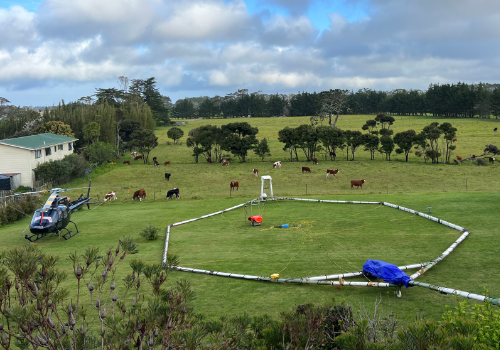
 AEM system take-off: a technician guides the operation as the helicopter lifts the antenna from the ground, ready to begin the survey.
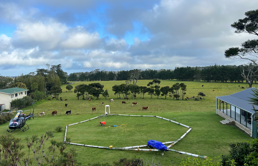 The AEM antenna resting on a paddock during an operational break. The helicopter is parked nearby while grazing cattle provide an unusual backdrop to the geophysical equipment.
Continuous magnetic monitoring
Geodesy and ground deformation
- GNSS densification network — 8–10 new semi-permanent stations for high-precision measurement of ground deformations.
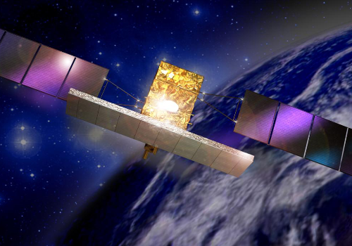
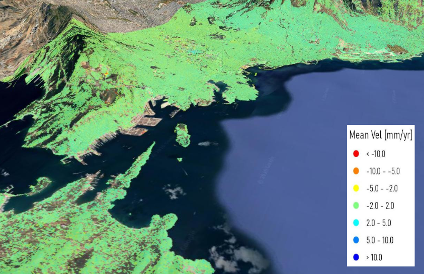
- Multi-temporal SAR interferometry (MT-InSAR) — Generation of sub-centimetre ground deformation maps from COSMO-SkyMed and Sentinel-1 satellite imagery.
Approfondisci
GNSS densification network
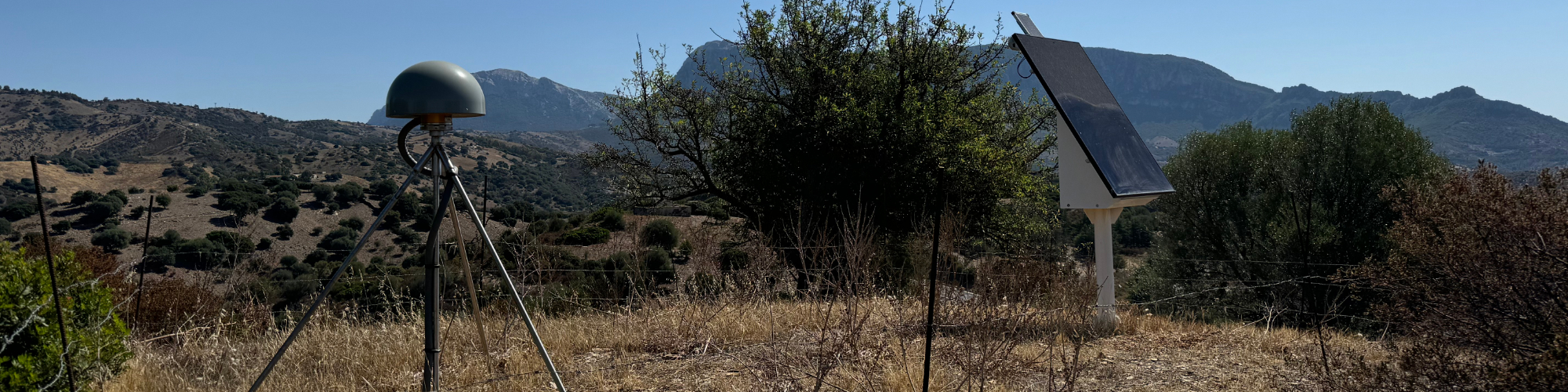
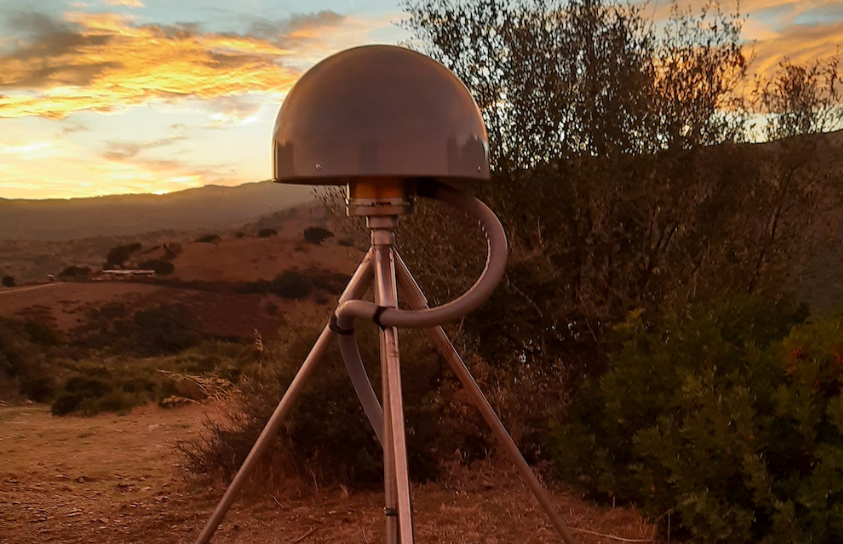 Tripod supporting the GNSS antenna of the SOSE station.
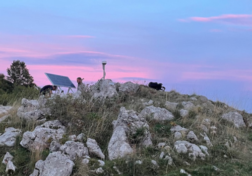
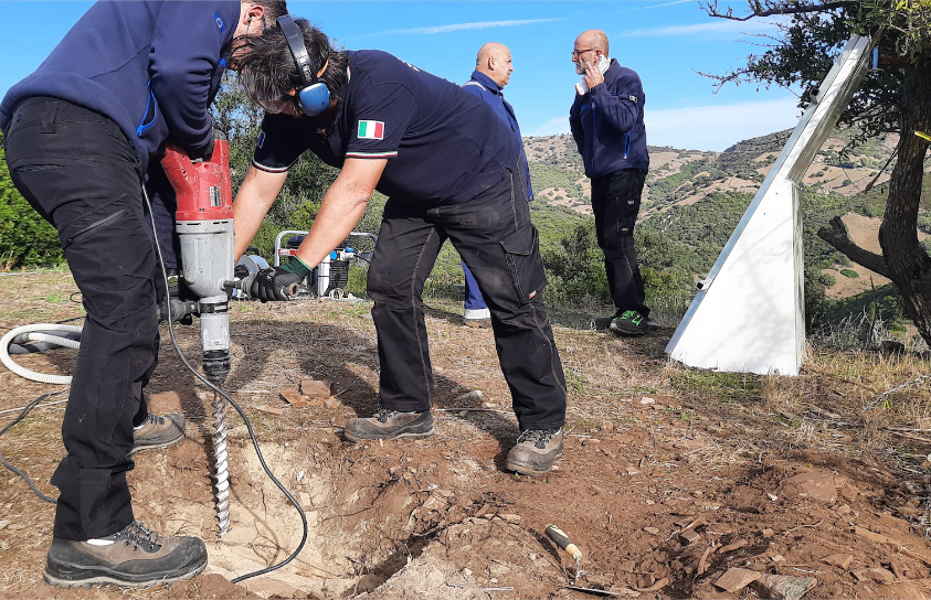 Installation of the SOSE GNSS station, part of the RING network (http://webring.gm.ingv.it) at Sos Enattos
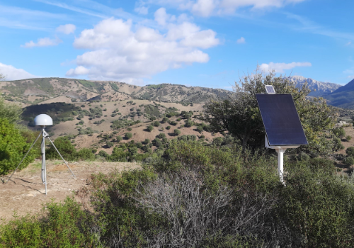
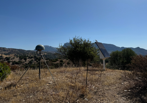
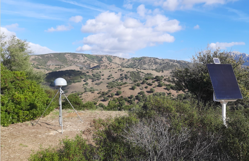 Complete SOSE GNSS station with solar power supply
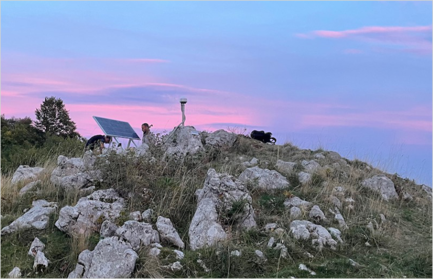 Semi-permanent low-impact GNSS station with solar power supply.
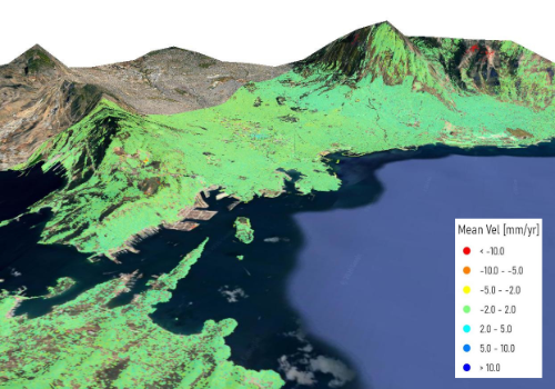
Multi-temporal SAR interferometry (MT-InSAR)
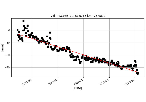
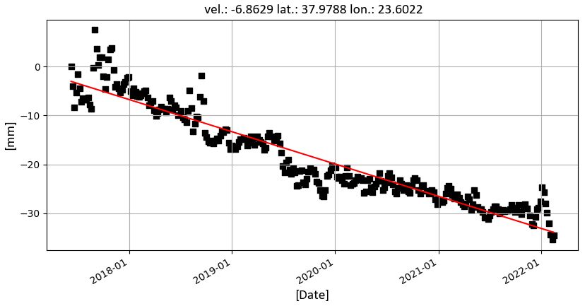
The MT-InSAR technique measures millimetric displacements of the Earth's surface using historical series of satellite images acquired with Synthetic Aperture Radar (SAR) sensors. For Sos Enattos, approximately 130 images acquired by the COSMO-SkyMed satellite of the Italian Space Agency (X-band SAR sensors, resolution ~3x3 m² on the ground) are processed, covering January 2022 to December 2025, in both ascending and descending orbits. 88 Sentinel-1 images (ESA, C-band) were also processed for September 2022–July 2025 using the Small Baseline Subset (SBAS) technique, with a ground resolution of 100 m. Final products are the average ground velocity map (mm/year) and displacement time series (mm); COSMO-SkyMed and Sentinel-1 results will be cross-validated.
The validated final products — average deformation velocity maps and displacement time series with precision of 1–2 mm/year — will allow identification of geological criticalities such as landslides and subsidence, and will be integrated with GNSS data to reconstruct the continuous displacement field of the area.
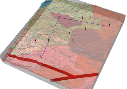
Structural geology and 3D modelling
3D geological model and Discrete Fracture Network (DFN).
Approfondisci
3D geological model and Discrete Fracture Network (DFN)